We offer a wide array of services including but not limited to-:
Geophysical and Hydro Geological Survey.
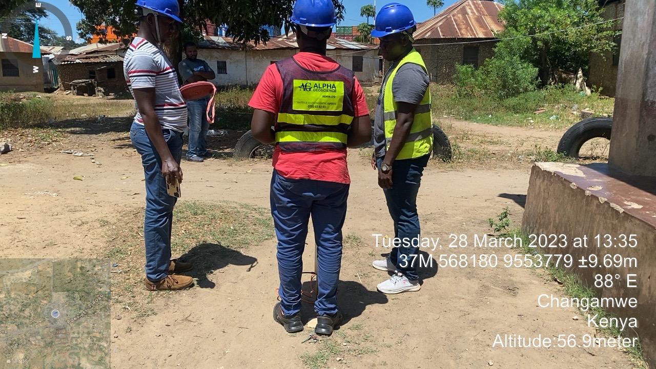
●Ground water survey (Assessment of groundwater resources in an area to advice on the viability of drilling a production borehole that can be used to supply water) Upon conducting the hydro cal survey, we do a follow-up to ensure that the client has been issued with the Pre requisite drilling permit by WRMA.
●Geological & Geophysical survey for evaluation and assessment of availability of road/construction
aggregate for proposed quarry sites.
.Geophysical logging( Recording and analyzing different parts of a borehole by lowering probes that continuously collect or point data that is physically displayed as a geophysical log
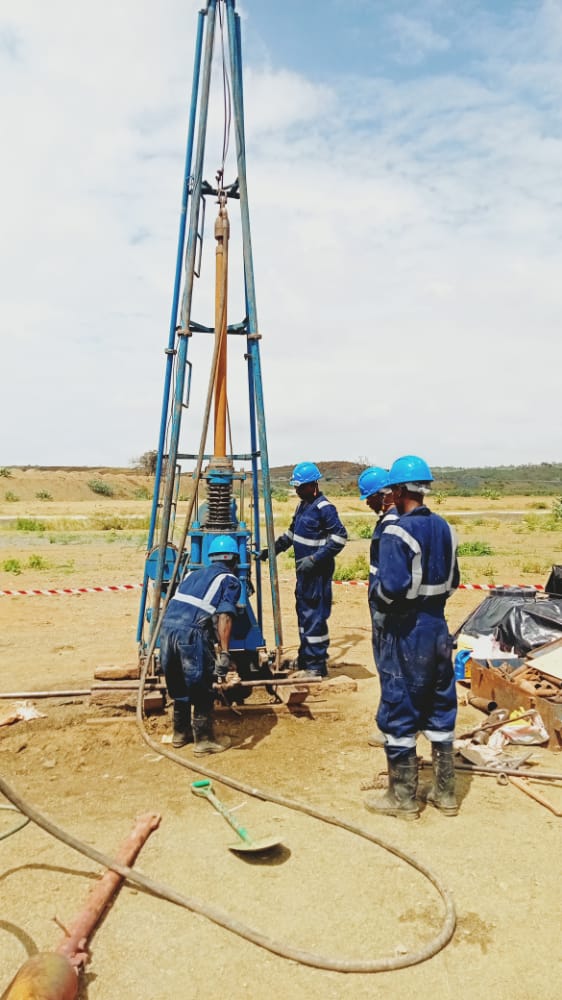
Borehole Drilling and Services.
.Assessment of base-line conditions prior to drilling
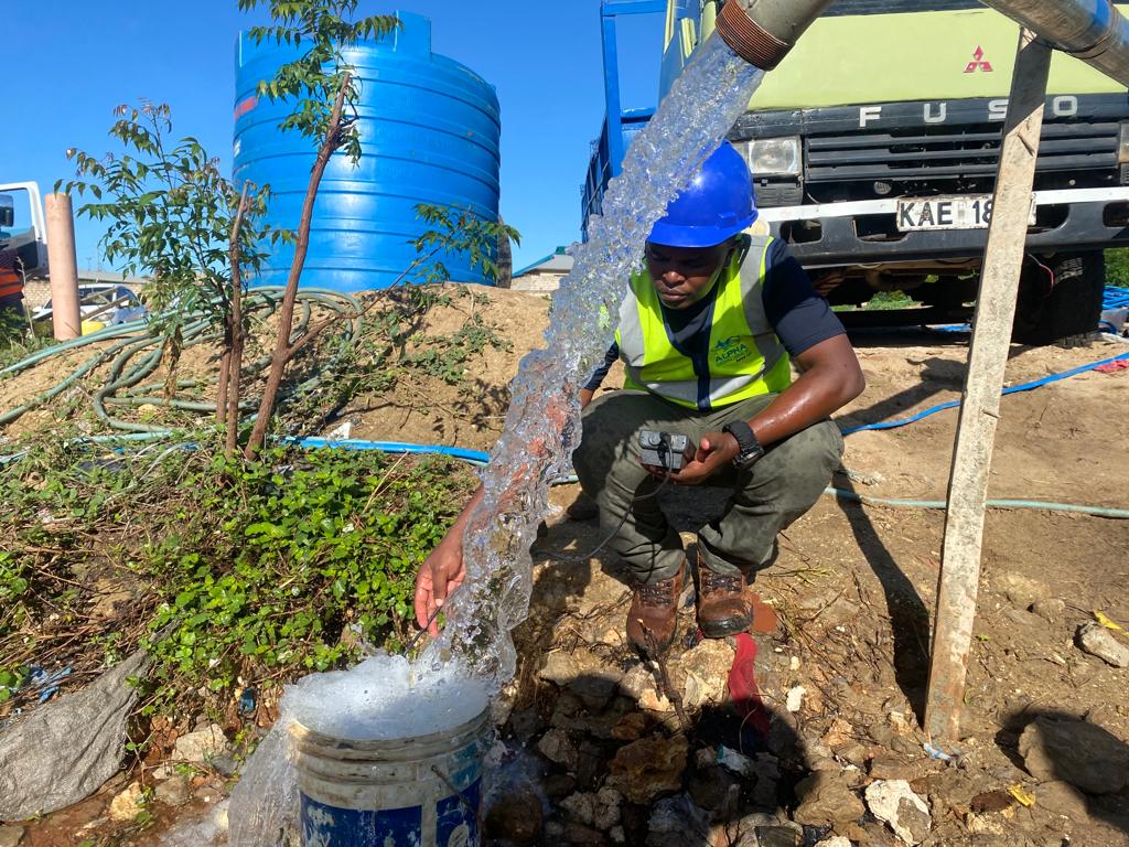
.Borehole drilling & development
.Geophysical logging
.Monitoring of post drilling conditions
.Borhole rehabillitation
.Test pumping services
.Installation of pumps
.Installation of ground water monitoring devices.
Geographical information system(GIS) & remote sensing.
●Use of GIS techniques to store, arrange,retrieve, classify, manipulate, analyze & present huge spatial data
& information in a simple manner & application of remote sensing as an essential tool for groundwater
studies especially for extended and complex systems.
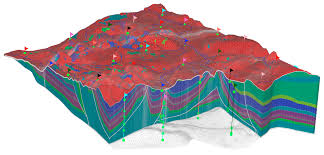
Ground Water Modelling
A groundwater model provides a quantitative framework for synthesizing field information and for
conceptualizing hydrogeologic processes. We utilize the latest public domain modelling tools
including SWAT, HEC-RAS, HEC-GeoRAS, HEC-HMS, HEC-GeoHMS, HEC-ResSim, WEAP, EPANET among
other open tools. We also develop in-house PYTHON and R programming for customized modelling
according to project needs. We also ensure maximum sustainability of the developed
models and study results for our clients avoiding licensing issues while working with most up to date
technologies. Fields of modelling expertise cover catchment hydrology, river hydrodynamics,
groundwater, water quality, erosion, sediment transport, ecological modelling and climate change
data downscaling.
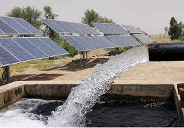
Solar pumping systems
Solar technology installed in water wells to provide rennewable power to boreholes. The solar
energy reduces the cost of extracting water.
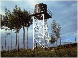
Civil works and fabrication
construction of water tower to support water tanks and solar structure – solar panels.
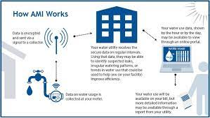
WATER BILLING SYSTEM & METERING INFRASTRUCTURE
- We provide all services to equip any city/organization to Install, manage and utilize an end-to-end
- Proper installation and management of smart/mechanical water meters and LoRaWAN network gateways for communication.
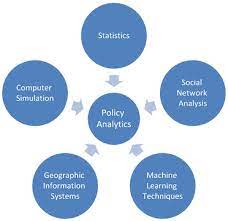
ANALYTICS AND POLICY
Augmentation System Services related to gathering data streams from smart meters / sensors and
analysis of that data on real time basis to provide intelligence and anomaly detections. Using
machine learning to understand patterns to predict events like pipe bursts before they happen.
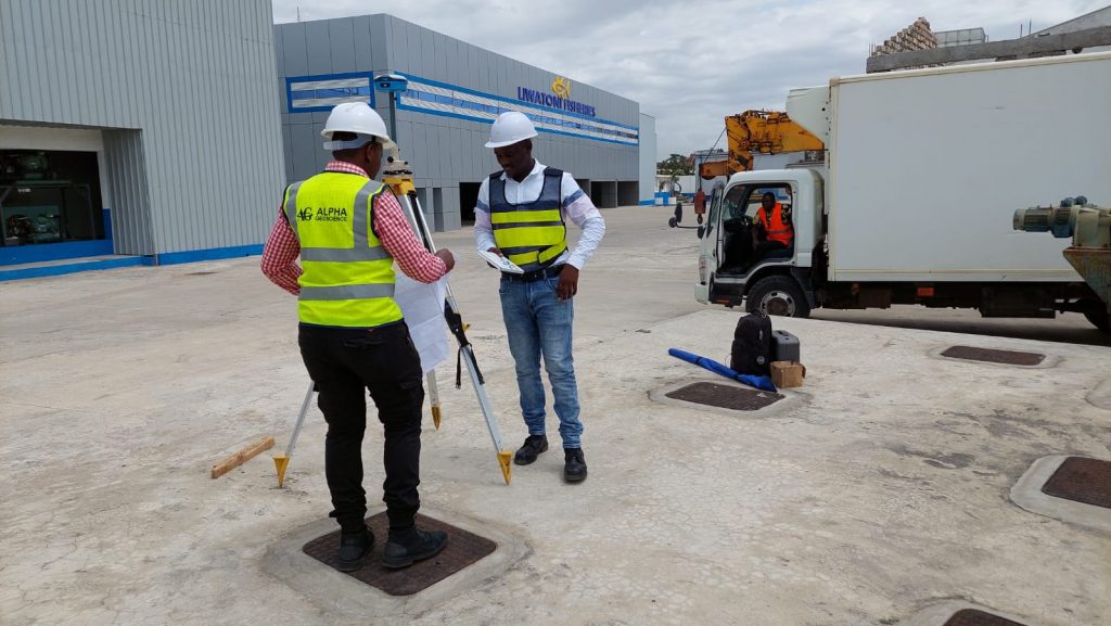
Geotechnical Investigation Works
- Alpha Geoscience (K) Ltd uses scientific methods to assess the soil, rock and groundwater conditions prior to the
- design and construction phases of developments projects. The Protocols and Standards adhered to during these
- Investigations are in line with the British Standard (BS 5930:1999), code of practice for site investigations, to
- ensure that reliable, consistent, qualitative and quantitative results are always obtained.
- We are familiar with multiple investigative techniques ranging from geophysics to rotary core drilling to in-situ
- testings and test piping, each with their own site-specific application and associated soil and rock laboratory
- testing.
- Specialist services include, but are not limited to, the following types of investigations;
- Large Structures:
- Deep foundation investigations for large structures such as Multistorey Buildings, Power Stations, Dams, Bridges,
- Power Lines, Shopping Center’s and buildings with multiple basement levels.
- Stability Investigations
- Stability investigations for sites underlain by Soluble Rock. Final Report makes recommendations on the suitability
- of the site for a proposed structure, based on the results from the Test Piping, Geophysical and slope stability
- analysis phases of the investigations.
- Bulk Water Supply Systems:
- Deep foundation investigation for the various infrastructural units forming part of bulk water supply systems
- such as Waste Water Treatment Works, Reservoirs, Elevated Water Tanks, Pump Stations and sub-surface pipelines; with the associated calculations required for detailed designs such as lateral earth pressures and bearing capacity.
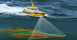
Bathymetric Survey
Bathymetric surveys are type of hydrographic survey which map out the details of under water terrain
illustrating the depth and land that lies beneath water body. Data can be collected for a variety of water bodies
including rivers, lakes and oceans using sonar technology or other specialized instruments. Resulting data can
be used to create detailed maps of under water features which are useful for a variety of application such as:
navigation, resource mapping and environmental studies.
Equipment – Water well drilling
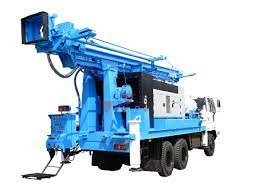
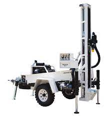
PRD SPEED STAR (SPIDER)
- Specifications
- Drilling depth – maximum of 365m
- Hole diameter range 165mm – 305mm
- Pull up force 10,000 kgf
- Mud pump (PRD 150):
- Discharge 600 lpm
- Total Head 30 mtr
- Input Speed – 1450 rpm
- Engine Power – 10HP
- Delivery Size – 65mm
- Suction Size – 75mm
- Discharge 477 – 915 lpm
- Maimum pressure 35 – 18 kg/cm2
- Stroke – 6” (152mm)
- Linear size – 6” (152mm)
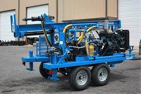
ROCKBUSTER R100
Specifications
- Drilling depth – maximum of 150m
- Hole diameter – maximum of 254mm
- Drill motor: Single speed 0-135rpms, 900-lbs (1220Nm)
Max Torque - Push Down: 10,000 lbs (@100rpms)
- Pull Back: 12,000 lbs (static) 12ft stroke
- Top Drive Water Swivel, 2” Side Inlet, 600 psi, Mayhew Junior Pin
- Mud Pump: Centrifugal 3” suction X 2”
discharge impeller, up to 35psi and 250gpm, circulation Bypass
PAT DRILL 301
Specifications
- Drilling depth – 150m
- Hole diameter 165mm
- Mud pump (TAKI):
PRD SPEED STAR (SPIDER)
Specifications - Drilling depth – maximum of 365m
- Hole diameter range 165mm – 305mm
- Pull up force 10,000 kgf
- Mud pump (PRD 150):
Discharge 600 lpm
Total Head 30 mtr
Input Speed – 1450 rpm
Engine Power – 10HP
Delivery Size – 65mm
Suction Size – 75mm